Topo Maps 2 is an offline map viewer; that is, you need to explicitly download the
maps that you want before you can view them. Once you have downloaded them they will
remain on your device until you explicitly delete them, and no internet connection is
required to view them.
To download detailed maps (or imagery):
Locate your area of interest, using the built-in maps or perhaps the app’s search
button.
Decide whether you want to download topographic maps, imagery or both. Select the
appropriate Map Mode, i.e. tap then
and select Topo, Imagery or Hybrid from
the menu.
Tap to open the Maps screen.

Tap at the top of the screen, if necessary.
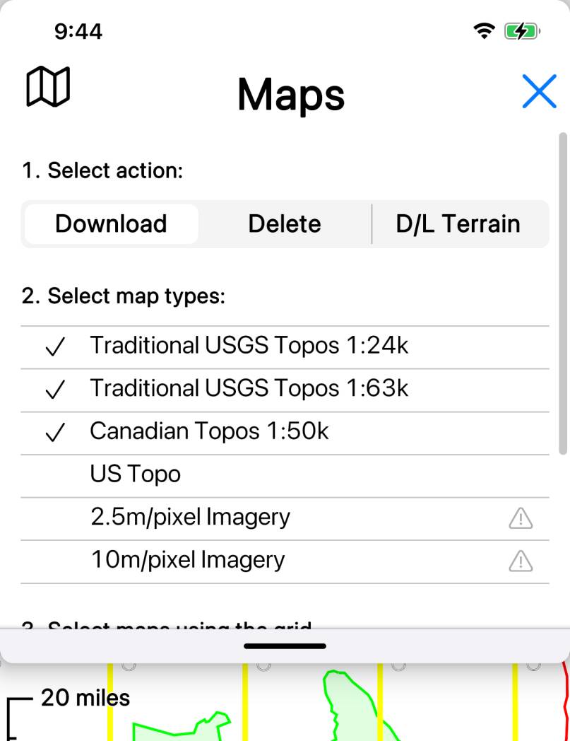
Note the list of map types. This will have been set according to your map mode, i.e.
in Topo map mode, most of the topographic map types will be selected. See below for
more about this.
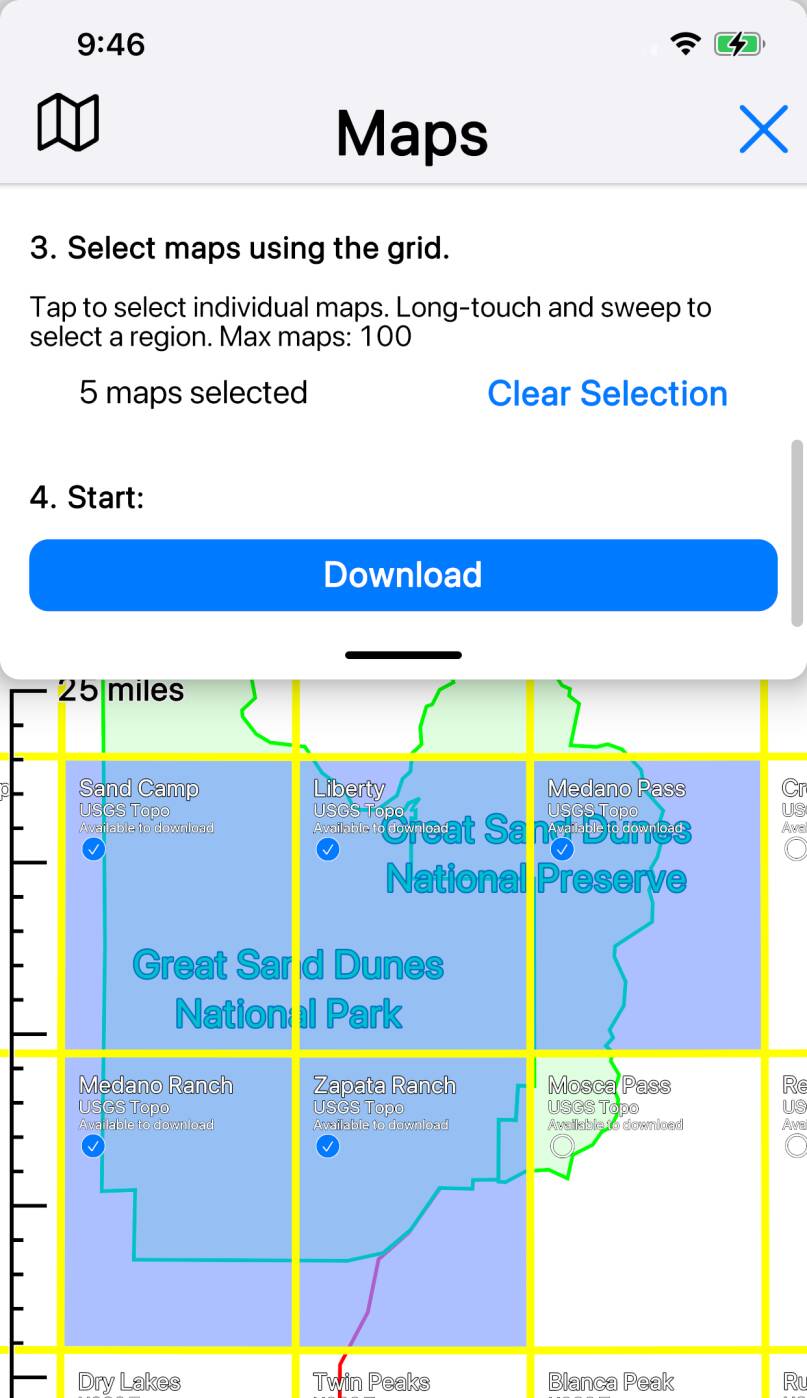
Note the yellow map grid. (If you don’t see any yellow grid, either you’re zoomed
out too far, or possibly zoomed in too far, or maybe you’re looking at somewhere outside
North America.)

Select the map(s) that you want to download. You can select individual maps by
tapping on their grid squares, or you can select blocks of maps by doing a long-touch
and then sweeping out an area.
Scroll the Maps screen to the bottom, and tap the blue
button.

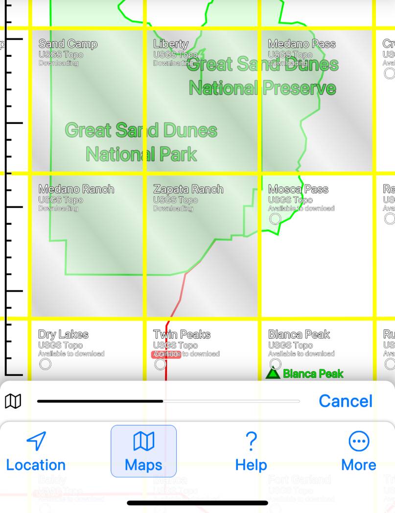
As the maps download, note the progress bar at the bottom of the screen (with a
button) and the diagonal animation effect on the map.
Close the map screen.
Zoom in to view your maps.
More about the Map Types list
Sometimes you will want to change the selected map types in the map type list.
Specifically:
- In “Topo” and “Hybrid” map modes, by default traditional USGS topos are selected. If you want to download US Topo maps or Forest Service maps instead, turn off the traditional topo types and turn on the alternative that you want. (If you turn on more than one type of map they will all be downloaded - but you will only see the traditional topos, unless you use a custom map mode to prioritize something else.)
- In areas on the US/Canada border where maps overlap, you may want to turn off either the US maps or the Canadian maps in order to be able to select what you want.
- In Alaska, in some areas both 1:24,000 and 1:63,360 maps are available; you may want to turn off one or other scale in order to be able to select what you want.
- In Alaska, Hawaii, Puerto Rico and the US Virgin Islands, currently both 2.5m and 10m imagery are available; you should turn off one or the other in order to be able to select what you want.
Downloaded Map Statistics

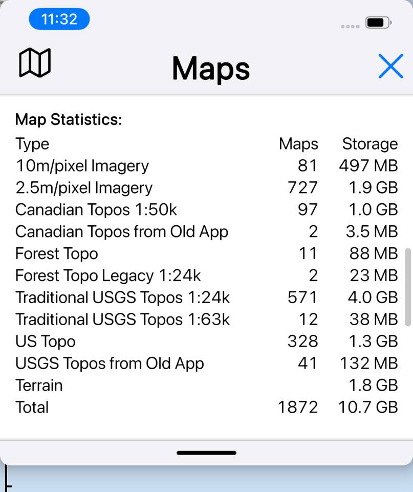
The bottom section of the Map screen shows statistics about the maps that you
have downloaded; for each map type, the number of maps and the amount of storage
used is shown.


